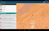
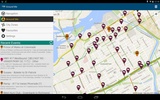
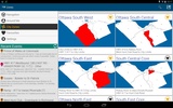
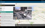
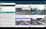

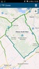


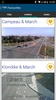
Ottawa Nav is an innovative connected city platform designed to facilitate real-time, zone-based communication between citizens and the City of Ottawa. This Android app focuses on enhancing urban navigation by delivering live traffic updates, road information, and camera feeds within a radius ranging from 2.5 to 100 kilometers. It leverages a zone-centric navigation mode, which turns each area into a smart space, making it an essential tool for anyone residing in or visiting Ottawa.
Enhanced Urban Experience
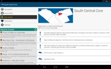
Harnessing advanced Flybits technology, Ottawa Nav transforms how information is accessed throughout Ottawa. Whether you're exploring Parliament Hill or visiting one of Ottawa’s renowned museums, the app provides instant access to opening times, historical context, and ongoing events related to each zone. This feature not only enriches your understanding of the city but also allows you to plan your activities efficiently.
Comprehensive City Insights
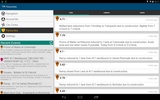
Beyond tourist attractions, Ottawa Nav integrates vital city services to streamline your daily experience. Keep abreast of local happenings with easy access to traffic camera feeds, and other essential services such as OC Transpo updates and Pay by Cell options tailored to specific zones. The app's robust infrastructure ensures that all vital information is just a tap away, providing a seamless urban experience.
Cutting-Edge Technology and Future Potential
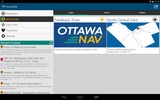
Ottawa Nav exemplifies the power of urban connectivity, made possible by a collaboration with the City of Ottawa and Ryerson University. As more zones are developed, anticipate updates that will introduce enhanced features and broaden the app's utility. Ottawa Nav serves as a comprehensive information hub, empowering users with the information they need to navigate and enjoy Ottawa to the fullest.
Requirements (Latest version)
- Android 3.0.x or higher required
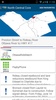
Comments
There are no opinions about Ottawa Nav yet. Be the first! Comment